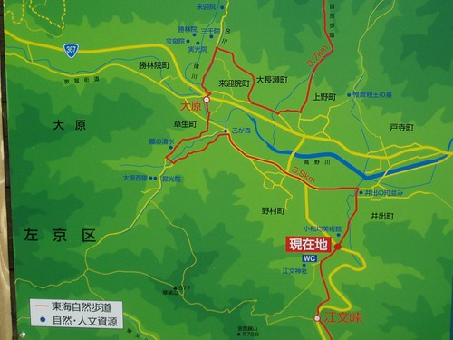
hopped off e first #17 Kyoto Bus at 花尻橋 Hanajiribashi somewhere to e right (south) of e map, & followed e path (yellow line) along e 高野川 Takano-gawa river, & then west along e red line through 井出町 to 江文神社. climbed from there up along e yellow line to e rock climbing area on e slopes of 金毘羅山 Konpira-san (+572.8m), & down again e same way, continuing along e red line all e way past e '3.9km' to 寂光院 Jakko-in temple & 大原 Ohara. crossing to e eastern side of e valley, climbed up along e red & then yellow line along e 吕川 stream past 来迎院 Raigo-in to 音無の滝 Otonashi-no-taki waterfall, before coming down e same way to 三千院 Sanzen-in temple (last bit to be covered in next post).
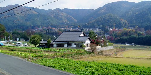
a very pastoral scene right out of e pages of a (Japanese =P) storybook:
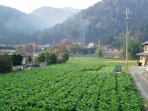
early morning mist over e farmhouses & vegetable patches at e foot of e tree-covered mountains....just ignore e intrusive telegraph pole ;)
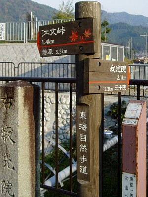
e further out of Kyoto city, e greater e lack of English/romaji translations....left fork towards 静原 dunno-what-hara (plain), 江文峠 dunno-what-toge (mountain pass) & Konpira-san (mountain):
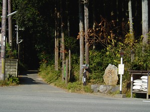
e little road leading into e woods & 江文神社 dunno-what-name-jinja (shrine):
original plan was to climb right to e top of Konpira-san & continue down to Jakko-in via 翠黛山 Suitai-san, but on e way up Konpira-san....
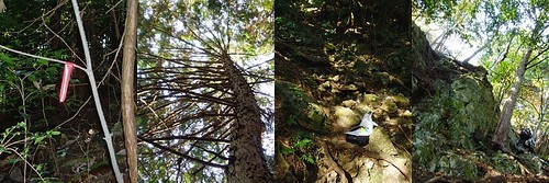
[1] e trail seemed to become less & less well-defined, until little red & blue tape markers were e only way to tell e way forward at many points; [2] a point was reached where a lot more sunlight started to penetrate through e tree cover; [3] at which e trail appeared to have been obliterated by rockfall; & [4] there didn't seem to be any way to continue further up without climbing gear
explored a little path leading off e left of e main trail that skirted around e base of e rockface, but it too ended up in a mess of fallen rocks. just as e cat was about to turn back, 3 white-haired grandpas appeared with backpacks, harnesses & plenty of ropes & carabenas. think both parties were equally as shocked to encounter one another in e middle of e woods =P
with quite a bit of sign language & e few words of English that one of them knew, confirmed that e 'non-technical' trail up to e summit was no longer accessible for now. but e disappointment was more than made up for - e spritely trio were happy to let e cat watch & photograph them as they unpacked their gear, changed from hiking boots into climbing shoes, sorted out their ropes & started their climb:
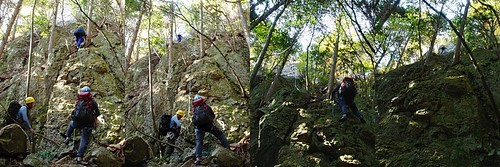
[1] ah peh #1 starts e first section of their climb [2] ah peh #2 in yellow helmet gets ready to go [3] with e other two up at e top of e first section, ah peh #3 sets off to join them, stopping now & then to remove e short loops of rope + carabenas that anchor e main rope to e base of tree trunks along e route [4] ah peh #3 disappears out of sight, & e cat starts its climb down
interesting how elderly Japanese spend their retirement =)
on e way down, e cat started to hear something like a Ricola Swiss herb candy advertisement resounding through e woods *YO-DE-LEEEEEEEE-YO-DE-LAAAAAAAAY-HOOOOOOOOOO* & e source of e yodelling got nearer & nearer & nearer until **POW** e cat literally kena knocked over by a super-friendly but far too over-enthusiastic big fat (taller than e cat) golden retriever-like dog with a wet wet nose. after getting back on its feet & sharing a good laugh with e super pai seh yodelling lady owner, e cat continued on its way past 江文神社 dunno-what-name-shrine back towards e Takano-gawa.
Konpira-san from afar:
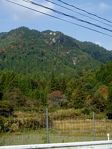
e little white patches are e bare rockfaces popular with climbers. obviously e cat didn't make it very far up e mountain =P
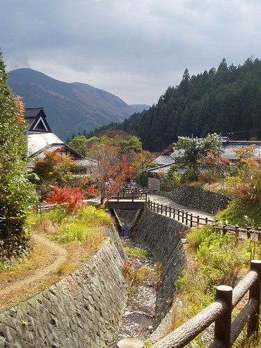
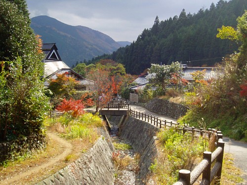
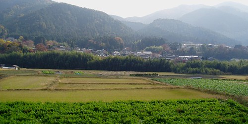
Ohara valley:
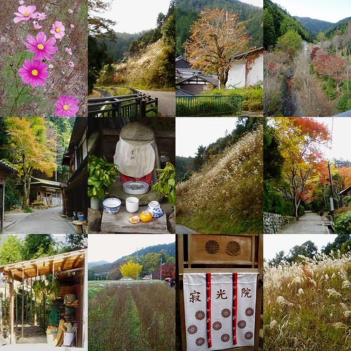
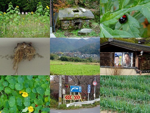
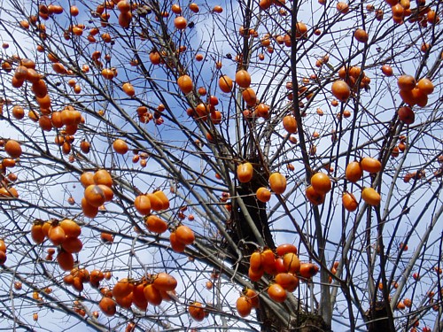
[1] e Cosmos flowers that bloom throughout Ohara in autumn [2, 7, 12] path leading to e 西の谷川都市対策砂防堰堤 dunno-what-gawa dam [3] persimmons just like e ones seen along e Yama-no-be-no-michi hike [4] 西の谷川都市対策砂防堰堤 [5, 8] path leading from Jakko-in to Suitai-san & 焼杉山 Yakisugi-yama [6] jizo [9] vegetables fresh from e fields to be pickled to make e tsukemono that Ohara is famous for [10] ginkgo [11] Jakko-in
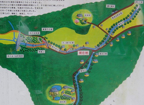
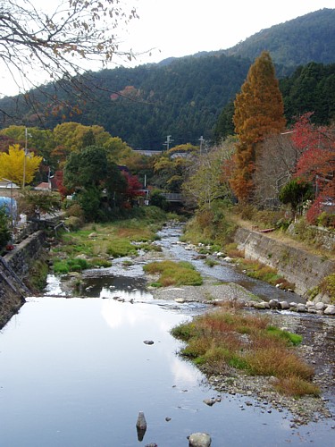
along e 西の谷川 dunno-what-gawa (Nishi/Sai-no-dani-gawa?), a tributary of e Takano-gawa:
'concretisation' & 'canal-isation' of waterways are as pervasive a phenomenon in Japan as in Singapore ;) e signboard below details e whole slew of modifications done to this particular tributary:
e slightly more natural Takano-gawa:
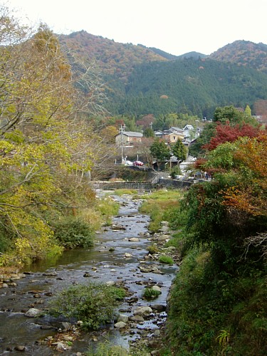
is this how it feels like to walk through a storybook illustration? =)
ginkgo in full banana-yellow autumn glory:
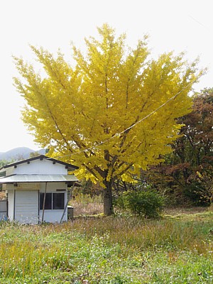
just looking at it lifts e spirits =)
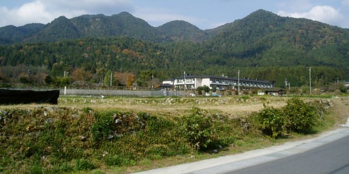
Konpira-san & Suitai-san towering above e Ohara valley:
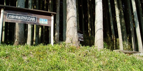
a viewpoint with a wooden bench & signboard for people to enjoy e views across e valley to e mountains in e east, built by a NPO (non-profit organisation):
大尾山 Daibi-zan, 仰木峠 dunno-what-toge (mountain pass), 水井山 Mizui-yama & 比叡山 Hiei-zan can be seen from here:

looking in e direction of 三千院 Sanzen-in temple below Daibi-zan:
仰木峠 directly across e valley:
more Ohara:
[1] sunflowers taller than e cat [2] something e witch in Hansel & Gretel would use [3] ladybird season - encountered plenty of them in Hozukyo e day before [4] bird's nest [5] Ohara valley [6] leftover from e last elections [7] cute leaves - what is this called? [8] 13'C - fine hiking weather =)
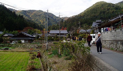
e path between Jakko-in & Ohara proper:
caught each other by surprise - both e woman & e cat didn't realise one another's presence until e picture was taken:
this valley is just so beautiful =))


No comments:
Post a Comment