[161105] Kiyotaki - Atago-san - Atago-jinja - Tukinowa/Gatsurinji - Kiyotaki
first, a site on e first part of e hike, with clearer photos:
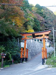
愛宕山の表参道torii at start of Atago-san 愛宕山 (+924m?) climb:
on e wall of a house just past e torii:
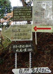
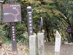
Japanese-illiterate cat couldn't make much sense of e couple of (warning?) signs at e start:
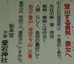
but at least this one doesn't have e words '落石' on it.
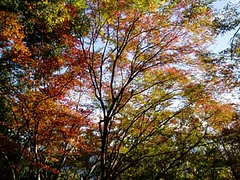
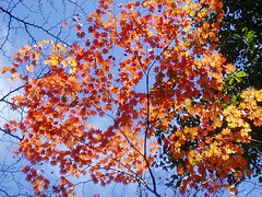
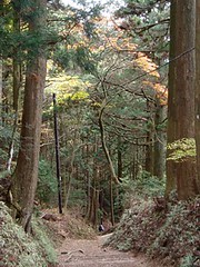
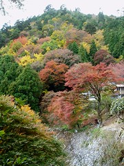
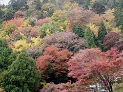
enjoying a different kind of (non-tropical) forest type. e ah pehs hurrying past probably wondered why this slowpoke cat was spending so much time looking up at e trees:
do not roast bears over an open fire? =P
there are jizo statues & stone markers with inscriptions that have been eroded by e elements, as well as signs at regular intervals that appear to mark e distance. never has e cat ever been so inspired by jizo statues & trail markers to press on =P e boring steps were as mind-numbing as those on e lower bit of Kinabalu's main trail, & there was no Ivan+Swee Cheng+Yangchen combination for entertainment value....took 1.5h (including photos & rest time) to reach e 五合目 junction - supposedly a 40-60 min climb on e hiking map.
五合目 appears on some maps as a junction with a trail leading down to Hozugawa river, but e cat didn't notice any other trail?
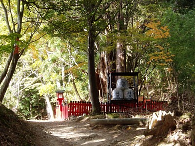
大杉大神 shrine at a large tree. e 3 casks of sake are to motivate tired sake-loving climbers? ;)
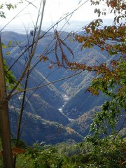
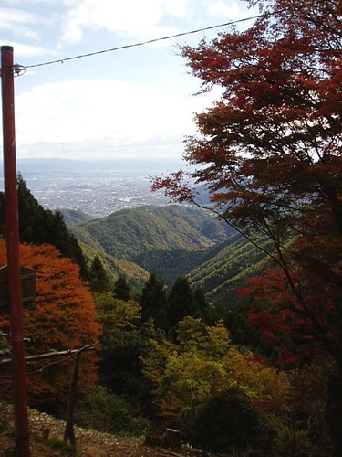
beyond this point, e trail started to level out for a while, & e Hozugawa(?) valley & west Kyoto started to appear between between e trees:
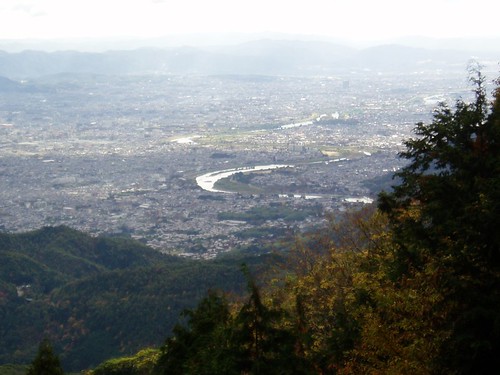
further on was e 七合目 rest stop at a wonderful vantage point with great views of Kyoto =)
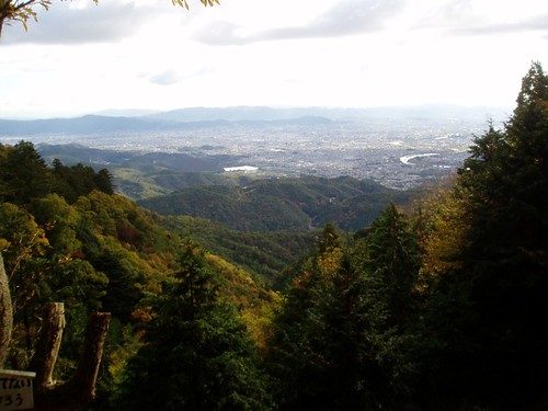
here e cat was joined by a group of Japanese hikers. a man started lecturing e cat on e geography of Kyoto - how it is bounded by mountains on 3 sides (north, east & west), has two main rivers running through it, with e Kamogawa being formed by e confluence of two other rivers, etc etc etc. rattled on & on for ages. in Japanese *lol* about 10 words of his lecture made sense - mountain/river names (Kitayama, Hiei-zan, Daimonjiyama, Atago-san, Kamogawa, Takanogawa, Katsuragawa etc) & directions (kita, minami, higashi, nishi), & his animated hand gestures helped e cat figure out that he was talking about a river confluence. class was over only when he walked over to e rest shelter to pee.
as we continued hiking, he came up to e cat again, & started rattling off in Japanese again. time to nihongowadekimasen him! *evil grin* e look on his face was priceless =P
junction with trail leading down to Mizuo, a small village that e cat wanted (but had no time & $$) to visit (together with a neighbouring village, Koshihata, & e much further away Kita in Miyama-cho) to see traditional thatched roof houses:
click to view larger version to read e words on e signs. couldn't find much info on tiny places like this (e.g. how to get from JR Hozukyo station to this village), & e Kyoto Prefecture Tourist Info Centre couldn't help much either. hope this will help those who manage hunt this pic down by Google.
more climbing from here, but not as jialat as e first section up to 五合目. a guy in blue coming up e trail behind e cat, who thought it had already been overtaken by every single person heading up Atago-san:
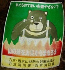
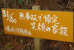
#31 (favourite no.!) out of this series of 40 signs planted along e trail by a few groups from e local fire departments(?). each seems to have some sort of fire safety message. e cat was tired by e time it got to #15 out of 40 =P
龙门客栈?
e Japanese climbers on e right were taken aback to meet a cat that [1] is foreign, [2] they thought was 16 years old, [3] is climbing Atago-san for e first time, & [4] is doing it solo (e 4 questions they asked), & very kindly offered to let it join their group =) but e cat wouldn't be able to keep up with their pace, especially with e photo-taking.
what e cat thinks is e fields of Mizuo start to appear in e gaps between e trees on e west side of e trail:
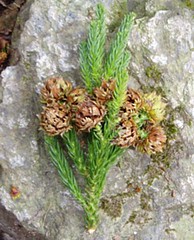
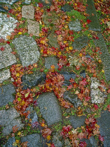
plenty of this on e forest floor:
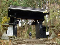
Kuromon, e black gate of Atago-jinja, at #39 out of 40:
at e 'top' of Atago-san:
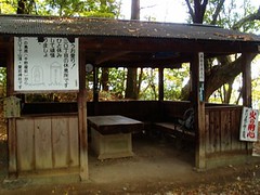
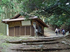
reached here at 11am - took 3 hours! here at e bottom of e steps leading up e 'bump' on Atago-san's profile to e shrine at e top are a few builidings, including a drop toilet, a shelter for climbers (on e night of 31st July people climb Atago-san to pray for safety from fire at e shrine), & cats =))
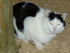
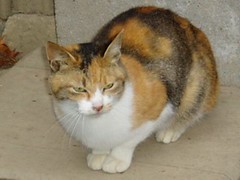
there was also one that looks like a Russian Blue, & a few kittens. this was to be e wettest day of e cat's Kyoto trip, & it started to rain (nature's sprinkler = safety from fire eh?)....e black & white one joined e cat in e shelter. it knew that e cat was going to have breakfast while waiting for e rain to pass. judging from its size it must be quite well-fed by climbers ;)
more long steep flights of steps up to Atago-jinja proper in e drizzle & mist:
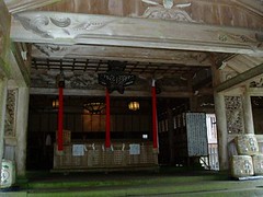
despite e mountain-top isolation with no vehicular access, Atago-jinja is just like any other Shinto shrine - with e requisite booth & staff on duty selling ema boards, o-mamori & paper 'charms' for protection against fires. what sets it apart from other shrines is e warm & toasty room to e right of e entrance, which has a wood stove & benches for climbers to escape from e cold, rest their legs & dry their gear =)
rain + mist + chill = ghostly atmosphere. e kind that makes you wonder if e rest of e world would still be there when you reach e bottom of e steps.
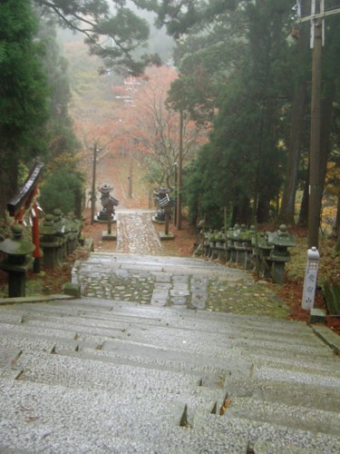
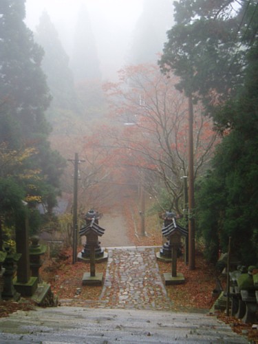
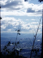
at e bottom of e steps e cat realised that it was literally walking in e clouds. took e fork leading to 月輪寺 Tukinowa temple aka Gatsurinji (depending on which map/signboard you believe; wonders if e signboards spelt 'tsuki' as 'tuki'?). e first few steps down e trail appeared like a super steep plunge into nothingness in e mist/fog. effect of rain + clouds/mist/fog on e view of Kyoto:
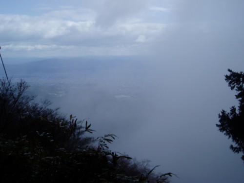
only recognisable feature for orientation was e big fat Hirosawano-ike pond (middle of photo), visible because it was reflecting e greatest amount of sunlight?
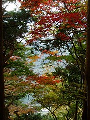
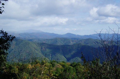
when e foul weather cleared:
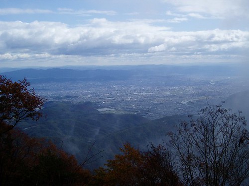
mountains - cat like!! =))
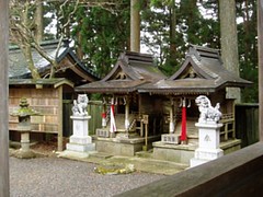
part of Tukinowa temple:
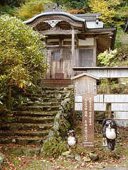
not a soul in sight, though there was a house with doors left wide open. this place is so beautiful:
trail continued down towards 空也滝. at a few points there were forks (not marked on map) with faded/unclear signage, or none at all. many a times e path diverged, only to join up again a short distance on. e cat somehow ended up at e paved forestry road marked on e maps & mentioned in e guidebook.
junction with e trail leading to Takao:
reached here at 2pm. from here it would probably take almost an hour to Takao (original plan), which wouldn't leave much good daylight for taking photos (sun already low in e sky ~3PM, & sets at ~4.45PM) & time to enjoy e maples at e 3 temples there. decided to end back at Kiyotaki - Takao would be for tomorrow.
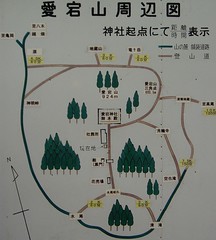
cat's route today:
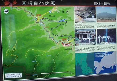
white dot of Kiyotaki 清滝 > yellow dotted line in clockwise direction > first white words on blue background (Atagojinja) > second white words on blue background (Tukinowa) > 空也滝 at junction with solid yellow line > solid yellow line to e right > junction with red line > back to Kiyotaki
tomorrow will be e red line from e topmost blue dot down to Kiyotaki =) e red line is part of this 700+(?)km network of trails that run across Japan from somewhere around Osaka all e way to somewhere around Tokyo (grey & blue map at bottom right).
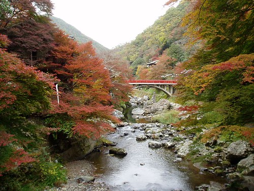
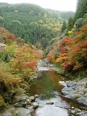
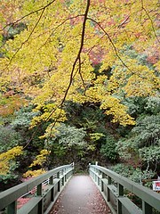
back at Kiyotaki in e afternoon:
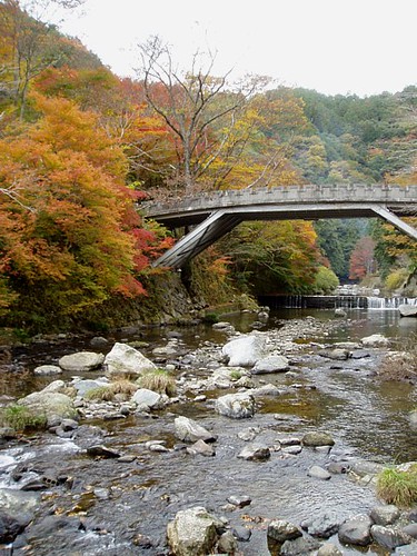
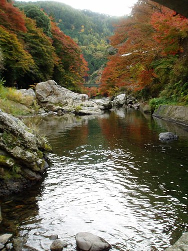
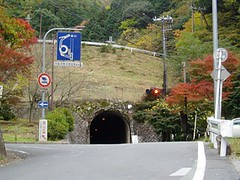
tunnel connecting Kiyotaki to e rest of e world, as seen from e bus stop:
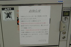
on e way back to Kyoto station, e bus passed through e crowds thronging Arashiyama - scary....Kyoto station lockers with e notice saying that they would be sealed because of President Bush's visit:
found grape-flavoured & wine-flavoured kit kat in e ampm konbini at Shichijo-Karasuma - omiyage =P here e cat also bought what looked like a sweet & sour pork rice bento for dinner, which turned out to be CURRY pork rice....tasted like Campbell's Oxtail soup - probably e weakest of weak Japanese curries?